Big rivers begin as many tiny streams, but figuring out which of those tributaries deserves to be called the source of the river is fraught with difficulties
But powerful rivers have humble origins.
Textbooks tell us that rivers start somewhere high up in the mountains. When rain falls, snow melts, or underground springs rise up, the water starts collecting in tiny creeks that flow downhill. Several tiny creeks join together to form larger streams, and numerous streams interweave and converge to form even larger rivers.
Obviously this means that a powerful river – an Amazon or a Nile – has dozens or even hundreds of starting points. But geographers like to simplify things. They try to pick, from all of these potential options, one single starting point: THE source of the river.
So how do they decide? And does the decision really matter?
“Different definitions of a river’s source have been used and continue to be used,” says Andrew Johnston, a geographer at the Smithsonian’s National Air and Space Museum in Washington DC.
There are, however, two major definitions that have been used more commonly than others.
You could end up arriving at two or more different answers for the source of a given river
Traditionally, many geographers and explorers have defined the source as the most distant point upstream that provides the largest volume of water to the river.
This is not a great way to define the source, though. Each tributary contributing to a river is different, and some flow at a different rate from season to season.
“The problem with this definition is that the amount of water in each branch varies through the year,” says James Contos, an avid kayaker and explorer, who also has a PhD in neuroscience. “So depending on when someone actually goes up the river and looks at it, they could end up following a completely different branch.”
Moreover, you would need several years of data on the flow of water to really know which branch supplies the most volume of water to the river. This kind of data is not readily available for most rivers, says Contos.
This means many decisions about true sources in the past were based on the tributary that “looked” like the one carrying the most water.
Once cartographers started mapping out entire river drainage basins, a second definition started gaining popularity. The source, according to this definition, is the farthest point upstream on the longest tributary of the river.
The sources of many large rivers are still unknown or disputed
This definition relies more on the length of a tributary than its water flow, so it is less likely to change from season to season.
“Historically, this information [on tributary lengths] wasn’t always known when applying names to rivers,” Contos says. “So names of rivers were given based on usually where most of the water came from.”
Depending on which definition or interpretation you prefer, though, you could end up arriving at two or more different answers for the source of a given river.
In fact, the sources of many large rivers are still unknown or disputed.
In the mid-1900s, a series of scientific expeditions zeroed in on another likely source
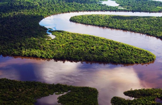
Take for example, the Amazon River. At about 3,850-4,350 miles (6,200-7,000km), the Amazon is one of the longest and most voluminous rivers in the world. It flows through six countries in South America – Peru, Bolivia, Venezuela, Colombia, Ecuador, and Brazil – before pouring out into the Atlantic Ocean.
But the “true” source of this enormous river has baffled many explorers over the past centuries, and continues to cause arguments even today.
In 1707, a geographer called Father Samuel Fritz published a map that pinpointed the source as Lauricocha Lake, upstream of the Maranon River in the Peruvian western Andes.
Fritz believed that the Maranon held the most water of all the Amazon’s tributaries, making it the most important headstream.
A number of expeditions confirmed and popularised Nevado Mismi as the true source
Then in the mid-1900s, a series of scientific expeditions zeroed in on another likely source: the upper reaches of Peru’s Apurimac River. But the exact location of the source kept changing.
First, Lake Vilafro in Peru was considered to be the Apurimac’s source, and hence the Amazon’s. But others believed that Mount Huagra, about 125 miles (200km) south of the city of Cuzco, was the true source.
Then in the 1960s, Carlos Penaherrera del Aguila, a Peruvian geographer, pinpointed Peru’s Nevado Mismi, a 5,597m-tall mountain in the Andes, as the source. Water from this mountain feeds into the Apurimac river.
Over the next three decades, a number of expeditions – including some supported by the National Geographic Society – confirmed and popularised Nevado Mismi as the true source.
Johnston was part of one such expedition in 2000. Every day for about two weeks that year Johnston sent out teams to walk different paths upstream of the river high up on Mount Mismi to map out the source region.
I was like ‘Gee! This is pretty major news’
At the end, Johnston’s team found that a small tributary called the Carhuasanta was the longest in the region, making its starting point the source of the Amazon.
In 2014, the focus shifted yet again.
Contos published a paper that identified an overlooked, and completely different tributary of the Amazon – Peru’s Mantaro River – as the true source.
His moment of discovery occurred in 2012, while preparing for a kayaking expedition on the Amazon River.
He tumbled into a rough part of the Amazon, losing his kayak and equipment
Contos was examining topographic maps of the region, tracing and marking various tributaries that he wanted to explore, when he noticed something. The Mantaro River, with its several curves and bends, appeared to be longer than the Apurimac.
“I was like ‘Gee! This is pretty major news’,” he says.
Contos measured the lengths of both the Mantaro and the Apurimac rivers on topographic maps and high-resolution satellite imagery. He also kayaked and trekked the entire stretch of Mantaro and Apurimac, and tracked his descents using high precision GPS units.
It was challenging work. Once during his expedition, he tumbled into a rough part of the Amazon, losing his kayak and equipment in the process. He managed to recover them the next day.
Water still flows past those dams in Mantaro, even though it may be a tiny trickle
Contos’s measurements confirmed his discovery: the Mantaro River was indeed 47-48 miles (75-77km) longer than the Apurimac. The new most distant source position that he pinpointed was at the Cordillera Rumi Cruz, a mountain peak upstream of the Mantaro.
However, some geographers have disputed Contos’s claims. According to them, Mantaro stays dry for about five months in a year when the Tablachaca dam, built in 1974, diverts its water through a 12-mile (20km) tunnel.
This, they say, means the Apurimac is still the Amazon’s source, because it is the longest, contiguously flowing tributary of the Amazon. Contos is not convinced by this sort of argument.
“If you want to think about it in the purest sense… water still flows past those dams in Mantaro, even though it may be a tiny trickle,” he says.
In 1937, two Members of Parliament fought in the House of Commons over the “correct” source of the Thames
So where does all this leave the current thinking on the source of the Amazon?
“It’s a little up in the air right now,” Johnston says. Depending on which definition you choose to use, you could end up at a source upstream of the Maranon, Apurimac or Mantaro.
The Amazon River is not an exception when it comes to this sort of dispute.
The source of the Nile still remains undetermined. And fierce debates have also surrounded the true source of far smaller rivers, like the River Thames in the UK.
It’s a little up in the air right now
In 1937, for instance, two Members of Parliament fought in the House of Commons over the “correct” source of the Thames, which flows by the UK’s parliament buildings.
There are two major contenders. The “official” source of the Thames recognised by the Ordnance Survey, Great Britain’s national mapping agency, is “Thames Head” located near the village of Kemble in the Cotswolds, a range of rolling hills in south-central England.
But many people believe that the true source of the Thames lies at Seven Springs, the source of the River Churn, which is the longest branch of the Thames.
In fact, if Seven Springs is considered the true source, that would add a further 14 miles (22km) to the Thames, making it the longest river in the UK. The River Severn currently holds the top spot.
Similarly, numerous scientists and explorers have tried to correctly identify the source of the world’s third longest river: the Yangtze in China.
Clouds happened to have covered the region in the satellite images he had studied
In 1985, for example, Wong How Man, a photojournalist and founder of Hong Kong’s China Exploration and Research Society (CERS), claimed to have found the source of the Yangtze at the head of one of its tributaries, the Damqu.
But 20 years later, while examining high-resolution satellite images of the region, How Man realised that he had missed a tributary that was actually over 0.6 miles (1km) longer than the tributary of the Damqu he had previously identified as the source in 1985.
He had overlooked this tributary, he writes, because clouds happened to have covered the region in the satellite images he had studied in the 1980s.
So in 2005 he embarked on a fresh expedition. This time, his team travelled all the way to the head of this overlooked Damqu tributary, at an elevation of 5,170m. This is the farthest source of the Yangtze, he writes.
Other scientists have also identified Damqu as the Yangtze’s longest tributary.
Liu Shaochuang, a scientist with the Institute of Remote Sensing and Digital Earth at the Chinese Academy of Sciences, for example, has explored the Yangtze multiple times. In 2008, his team identified a spring at 5,054m above sea level on the north slope of the Dangla Mountains as the source.
Officially, though, based on the work of explorers from the China Geographic Research Institute in 1976, the shorter Tuotuo tributary of the Yangtze is considered to be the source.
In most situations, they will refuse to correct their mistakes
With so many contenders, how does a particular source become official?
The simplest way is for government officials to announce it, Shaochuang says. “But simplest is also the most difficult,” he adds.
“This is because the wrong source can also be announced by the governmental officials. In most situations, they will refuse to correct their mistakes. But the Chinese Government will announce the Yangtze, Yellow and Mekong sources according to my conclusions in the near future.”
In India, the Survey of India (SoI) – India’s national mapping agency – makes geographic places official. So if a place is on an SoI map, it becomes official, says Swarna Subba Rao, former Surveyor General of India.
“But we don’t specifically say this is the source of the Ganga, and so on. That is not our job. We just completely map the catchment area and name the places the river passes through.”
Maps of adequate scale are crucial for explorers. But accessing topographic maps is not always easy.
Satellite imagery can be low-resolution and you can miss certain curves and bends in the river
“For most countries, detailed topographic maps are considered as confidential information and not available from market,” Shaochuang says. “For some regions where the sources are located, the terrain is not mapped even today.”
In such cases, satellite remote sensing images become a fallback option. But these have limitations.
“Satellite imagery can be low-resolution and you can miss certain curves and bends in the river,” Contos says. “In other cases, it can be just one snapshot of where the river channel is, and the channels change from year to year. One year, the channel may meander around many curves. Another year, it may take a straighter path. This can change things enough to change what the source point is.”
Depending on which source you consider to be “true” for the Amazon and the Nile, either one could become the world’s longest river
Even going to the river and tracking its entire course using a high-precision GPS unit can introduce inaccuracies, Contos adds.
“When you’re floating down a river, you have to account for stops for camping and various other reasons. You have to adjust and take those into consideration to get an accurate measurement of where the water actually runs.”
Does knowing the “true” source of a river really matter?
It does. The precise location of the source is helpful for planning the management of the river and developing effective ways to protect the environment of the source regions, Shaochuang says.
But it matters mostly because we are curious about our world, Johnston adds. “We often like to know how tall mountains are, where a river comes from and where it goes. So it is less of a matter for scientific understanding, more for discovery and exploring the world.”
For example, depending on which source you consider to be “true” for the Amazon and the Nile, either one could become the world’s longest river – something trivia buffs might want to keep in mind.
The precise location of the source is helpful for planning the management of the river
Decisions on the source of a major river can also have important implications for locals.
In 2012, for example, Malay Mukhopadhyay, a professor of geography at the Visva Bharati University in West Bengal, India, visited the River Thames in the UK. Inspired by the stone plaque that certifies Thames Head as the river’s source, Mukhopadhyay decided to introduce a similar scheme in India.
So in December 2015, he traced what he believes to be the real source of Ajay River, a major river in eastern India, and placed a big marker stone at the site. Mukhopadhyay says that marking sources like this opens up the possibility for geo-tourism in an area that was previously completely unknown.
“One villager told me, now that you have placed this marker stone, maybe one day lots of tourists, from far-away places, will come to my village. My children will see them. Then they will be inspired to go out, see the world.”
Rivers shape our lives in more ways than one. These masses of water are powerful and mysterious, and knowing where a river begins is a key to solving this mystery.
Source: BBC













Leave a Comment
You must be logged in to post a comment.