
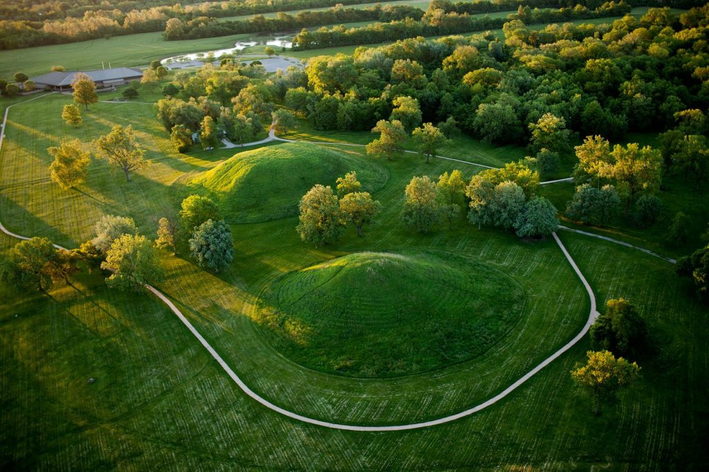
Mississippi floods shaped the rise and fall of the prehistoric metropolis known as Cahokia.
Researchers have long debated the reasons behind the rapid rise and swift disappearance of Cahokia, a sprawling, ancient city-state near the modern city of St. Louis. Now an analysis of sediment cores reveals that the city’s ups and downs correspond to the timing of Mississippi River megafloods, according to a recent study.
Archaeological data show that agricultural settlements first appeared in the area around A.D. 400. Around A.D. 1050 there was a veritable boom at Cahokia, which became a major political and cultural center with a population in the tens of thousands. But by 1350—a span of only three centuries—Cahokia was gone. (Discover Cahokia.)
To uncover clues to the city’s fate, a research team led by University of Wisconsin-Madison geographers Samuel Munoz and Jack Williams performed laser diffraction particle size analysis on sediment samples from Horseshoe Lake, an oxbow lake near Cahokia. The samples yielded evidence of eight separate flood events over the past 2,000 years.

Art: Greg Harlin
Sources: Bill Iseminger and Mark Esarey, Cahokia Mounds State Historic Site; John Kelly, Washington University in St. Louis
The researchers discovered that changes in the magnitude and frequency of the newly identified floods correspond with archaeological evidence for changes in population, land use, and settlement over the full history of Cahokia.
A flood-free period begins around A.D. 600, a time when settlements moved from higher slopes along the edges of the Mississippi floodplain down to the floodplain proper. Crops were cultivated more intensely and the population began to grow. In time Cahokia would become the largest prehistoric settlement in the United States.
So what caused the city’s downfall? Drought, overexploitation of resources, and human conflict have all been proposed as reasons behind the end of Cahokia. But an earlier study of sediments from Horseshoe Lake suggested that major flooding had occurred in the area around 1200.
Munoz and his team analyzed sediments from another oxbow lake 120 miles (190 km) downstream of Horseshoe Lake and found confirming evidence of the catastrophic flood. The Mississippi River rose more than 33 feet (10 meters) and played a critical role in the total abandonment of Cahokia within 150 years.
Munoz, whose research was funded in part by a Young Explorers Grant from the National Geographic Society, hopes the findings encourage archaeologists to add prehistoric flood records, when available, to their toolkit. “It’s always great when we can integrate geoarchaeology into traditional archaeology,” he says.
Source: National Geographic


Leave a Comment
You must be logged in to post a comment.