
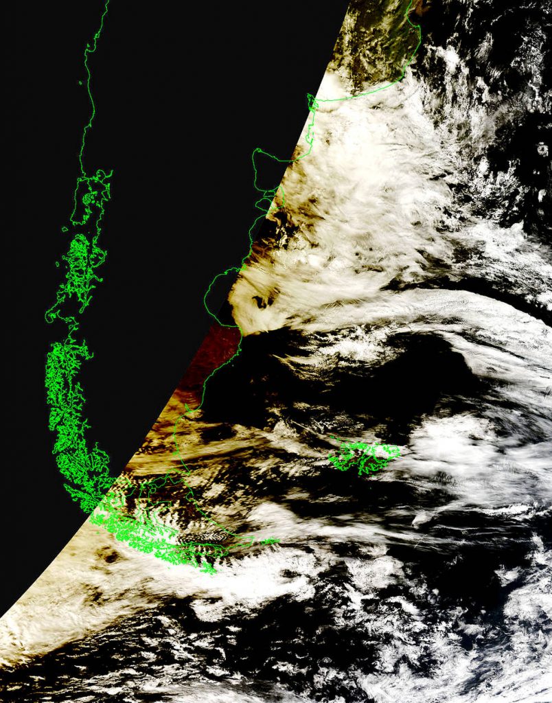
On Feb. 26, 2017, an annular eclipse of the sun was visible along a narrow path that stretched from the southern tip of South America, across the Atlantic Ocean and into southern Africa.
Those lucky enough to find themselves in the eclipse’s path saw a fiery ring in the sky. Meanwhile, NASA’s Terra satellite saw the eclipse from space.

During an annular eclipse, the moon passes between the sun and Earth, blocking sunlight and casting a shadow on Earth. But the moon is too far from Earth to completely obscure the sun, so the sun peeks out around the moon. Looking down on Earth, the Moderate Resolution Imaging Spectroradiometer, or MODIS, aboard NASA’s Terra satellite spotted the moon’s shadow over Patagonia.

Between two to four solar eclipses occur each year. Later this year, on Aug. 21, 2017, a total solar eclipse – in which the moon completely obscures the sun – will cross the United States, from Oregon to South Carolina.
Source: NASA


Leave a Comment
You must be logged in to post a comment.